How Drone Photography Transforms Landscape Shots?
A landscape never looks the same once you’ve seen it from above. Drone photography for landscapes in Los Angeles has redefined how we experience terrain, turning familiar scenes into striking visual narratives that feel fresh, expansive, and deeply immersive.
A New Way to See the Familiar
Traditional photography keeps you grounded. Drones lift that limitation. With aerial access, photographers can reveal patterns, symmetry, and scale that remain hidden at eye level. Coastal cliffs, desert textures, and urban skylines in Los Angeles gain a new identity when captured from the sky.
This shift is not just about height. It is about perspective. A winding road becomes a visual story. Ocean waves form rhythmic compositions. Even a crowded city appears calm and structured when viewed from above.
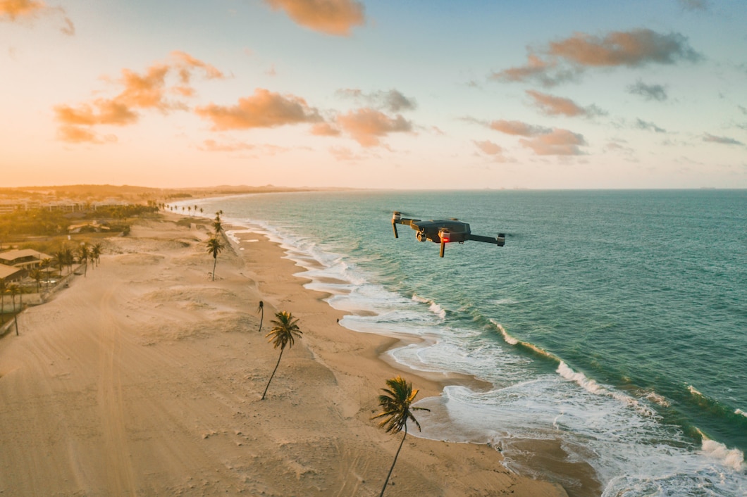
Precision Meets Creativity
Working with a professional drone company in Los Angeles adds a layer of technical accuracy that enhances creative output. Advanced drones allow controlled movements, stable framing, and high-resolution imaging. This means every shot can be intentional rather than accidental.
Lighting also behaves differently in the air. Golden hour spreads across a wider canvas, creating gradients that feel almost painted. Shadows stretch longer and add depth, making landscapes more dynamic and emotionally engaging.
Unlocking Data Through Visuals
Drone photography is not limited to artistic appeal. It plays a key role in data-driven imaging. With photogrammetry services in Los Angeles, aerial shots are converted into accurate maps, 3D models, and detailed measurements.
This means better planning, clearer visualization, and informed decision-making for landscape projects. Architects, developers, and environmental planners rely on these visuals to understand terrain with precision that ground photography cannot provide.
Elevating Storytelling in Landscape Photography
Every landscape has a story, but drones help you tell it better. Aerial sequences can guide the viewer’s eye from one element to another, creating a natural flow within a single frame.
Instead of capturing isolated beauty, drone photography connects elements. Mountains, rivers, roads, and structures come together in a cohesive visual narrative. This storytelling aspect is what makes aerial landscape photography so compelling.
Why It Matters Today
In a world filled with images, standing out requires a different point of view. Drone photography offers that difference. It brings originality without forcing it. It enhances reality rather than altering it.
This approach builds a stronger visual identity for photographers, brands, and businesses. For viewers, it offers a perspective that feels both new and authentic.
A Higher Perspective, A Deeper Impact
Drone photography does more than change how landscapes look. It changes how they are understood. By combining creativity with precision, it opens possibilities that were once out of reach.
The result is not just a photograph, but an experience. One that invites the viewer to pause, explore, and see the world from a place they may never physically reach.
Frequently Asked Questions
What makes drone photography better for landscapes compared to traditional methods?
Drone photography captures elevation, scale, and spatial relationships that ground-based shots cannot achieve. It reveals patterns and depth while offering a broader field of view, making landscapes appear more immersive and visually complete.
Is drone photography suitable for commercial landscape projects?
Yes, it is widely used in real estate, tourism, and urban planning. Aerial visuals provide clarity and detail, helping businesses present landscapes in a more engaging and informative way to clients and stakeholders.
How does photogrammetry enhance landscape photography?
Photogrammetry converts aerial images into precise 3D models and maps. This adds analytical value to visual content, allowing professionals to measure distances, study terrain, and plan projects with higher accuracy and confidence.
Do I need professional services for drone landscape photography?
Hiring a professional drone company ensures compliance with regulations, better equipment handling, and superior image quality. It also reduces risks while delivering consistent and polished results for both creative and commercial needs.
What factors should be considered before a drone landscape shoot?
Key considerations include weather conditions, lighting timing, location permissions, and flight regulations. Proper planning ensures smooth execution and helps capture landscapes in their best natural form without unnecessary complications.
Recent Posts
- How Drone Photography Transforms Landscape Shots?
- Key Factors to Consider Before Investing in Drone Photography for Your New Business
- How Professional Drone Photography Enhances Brand Visuals?
- How Drone Photography is Transforming Business Visibility?
- The View from Above: Why Construction Sites Need Drone Documentation
- How Drone Photography Transforms Wedding Memories?