Recent years have seen significant revolutions in the construction sector, with technology being essential to improving productivity, security, and project management. Aerial photography with drones in Los Angeles has become a revolutionary tool, offering previously unheard-of insights and capabilities that conventional monitoring techniques just cannot match.
The complexity and demands of construction projects are making contractors and project managers look for creative ways to solve problems with resource management, progress monitoring, and site supervision. Further in this blog, we will explore how drones for aerial photography are essential for thorough, affordable, and real-time monitoring solutions in the construction industry.
Enhanced Site Mapping
Construction teams now have access to extremely accurate and detailed site representations with drone technology. It has completely changed the mapping and surveying procedures. Previously requiring days or weeks of human surveying, advanced drone systems with high-resolution cameras and LiDAR technologies can produce precise 3D topographical maps in a matter of hours.
With the help of these aerial surveys, project managers may get a thorough understanding of the site, spot possible problems, and make informed decisions. The capacity to create intricate digital terrain models facilitates planning excavation projects, comprehending site circumstances, and guaranteeing the best possible use of available land.
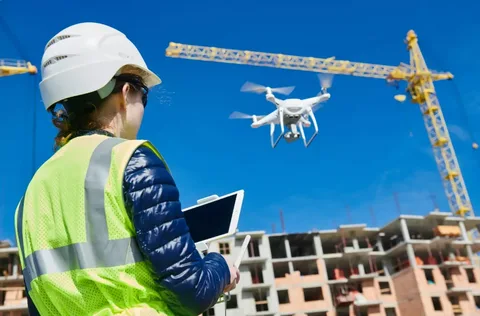
Real-Time Progress Tracking and Documentation
Drones offer an unmatched alternative for thorough documentation, which is essential for construction projects that require careful progress monitoring. They are used to produce a visual chronology of project development by taking high-resolution pictures and movies from various angles. These visual records have several uses, including assisting in the identification of possible delays or inconsistencies, facilitating communication with stakeholders, and providing proof of work accomplished.
Cutting-edge drone software can create thorough progress reports and point out variations between the original project plans and the site’s current conditions. Project management, insurance, and settling possible conflicts all benefit greatly from this degree of documentation.
Safety Monitoring and Risk Assessment
Drones can do thorough inspections of structural components, hazardous zones, and hard-to-reach regions, saving human workers from being exposed to potentially harmful situations. Thermal imaging with aerial photography for construction makes it possible to identify heat fingerprints that could point to structural or electrical problems. Moreover, drones assist in identifying safety risks, evaluating possible dangers, and enabling proactive prevention methods by offering aerial perspectives.
Resource Management and Inventory Tracking
The success of construction projects depends on effective resource management, and drones provide previously unheard-of capabilities for tracking and managing supplies and machinery. Quick material stockpile assessments, precise equipment location tracking, and inventory level monitoring are all made possible by aerial surveys. This real-time tracking helps in resource allocation optimization, theft prevention, and loss prevention. Managers can make well-informed decisions and expedite operational procedures by using automated reports on material consumption, equipment utilization, and possible inefficiencies produced by sophisticated drone systems with AI integration.
Cost-Effectiveness and Efficiency
Even while the initial investment in drone technology may appear high, the long-term advantages greatly exceed the expenditures. Drones significantly cut down on the amount of time and manpower needed for site surveying, documentation, and monitoring. They provide more precise data collection, cut down on project delays, and reduce the need for costly manual inspections. This results in significant cost savings, better project schedules, and better project management overall.
Incorporating drone technology into construction site monitoring is a revolutionary strategy. Aerial photography for construction in Los Angeles shows how technological advancement may transform conventional industry practices, providing unprecedented levels of safety, efficiency, and insight.