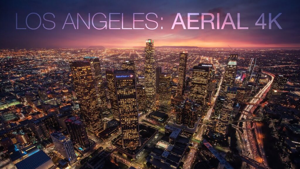
Drone Photography for Landscapes in Los Angeles
Los Angeles offers some of the most diverse and breathtaking landscapes in the world — from dramatic coastal cliffs and golden beaches to rugged mountains, desert backdrops, and iconic urban skylines. At Domlockaerials, we specialize in capturing these views like never before through professional drone photography for landscapes in Los Angeles.
Our experienced team uses cutting-edge drone technology to deliver stunning, high-resolution aerial imagery that showcases the true beauty and scale of the LA landscape. Whether you’re a real estate developer, filmmaker, tourism agency, or content creator, our drone photography services are tailored to elevate your project with striking visuals from above.
Elevate Your Vision with Domlockaerials
- At Domlockaerials, we believe every landscape tells a story — and the best way to tell that story is from the sky. Our drones are equipped with 4K and 6K cameras that capture dynamic, cinematic shots with incredible clarity and detail. From sunrise over the Pacific Ocean to sunset in the Hollywood Hills, we bring your vision to life with every flight.
Why Choose Domlockaerials?
✔️ Expertise in LA Landscapes – We know the city’s geography, lighting, and flight conditions, giving us an edge in capturing its most scenic spots. Whether it’s the LA River, Runyon Canyon, or the Santa Monica coastline, we get the shot.
✔️ FAA-Certified & Insured – Safety and legal compliance are our priorities. We’re fully certified to operate drones commercially throughout Los Angeles and secure all necessary permits for public or restricted airspace.
✔️ Creative Collaboration – We work closely with you or your team to plan, scout, and execute every drone shoot to fit your creative needs and goals.
✔️ High-Quality Deliverables – Expect professionally edited, color-corrected aerial images and videos delivered in the format that works best for your project.
Domlockaerials offers advanced 3D photogrammetry services in Los Angeles, delivering accurate, high-resolution 3D models and maps using cutting-edge drone technology. Ideal for construction, surveying, real estate, and site planning, our photogrammetry solutions provide precise spatial data to support your project from start to finish.
FAQs
Not everywhere. Many areas in LA, especially near airports or restricted zones, require FAA approval and possibly local permits. At Domlockaerials, we manage all legal clearances and ensure every flight is safe and compliant.
We shoot in 4K and 6K resolution, providing ultra-high-definition photos and videos suitable for both print and digital use. You’ll receive professionally edited files ready for immediate use.
Most aerial landscape sessions range from 1 to 3 hours, depending on the location, lighting conditions, and project scope. We plan ahead to capture the best natural light and angles for your desired look.
3D photogrammetry is a process that uses drone-captured images to create accurate, high-resolution 3D models and maps of physical environments. At Domlockaerials, we use this technology to support construction planning, land surveying, real estate visualization, and more — helping you save time, reduce costs, and improve decision-making with precise spatial data.
Our drone-based photogrammetry delivers centimeter-level accuracy, depending on site conditions and project needs. We use RTK-enabled drones and advanced software to ensure reliable measurements for architectural planning, volumetric analysis, and topographic mapping across Los Angeles.
