The View from Above: Why Construction Sites Need Drone Documentation

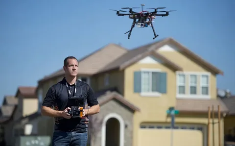
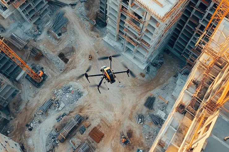
Construction delays are expensive, and misunderstandings are even more costly. Unmanned aerial vehicles with high-resolution cameras are used in drone photography to capture breathtaking overhead views that are impossible to achieve in photographs taken from the ground. Aerial documentation is no longer optional for construction managers managing several sites, deadlines, and stakeholders.

The best drone photography services in Los Angeles give construction teams precise, up-to-date visual documentation that helps them avoid expensive errors and maintain project timelines. Let’s examine why drone documentation is becoming an essential part of smart contractors’ workflows and how the benefits of this technology greatly outweigh its costs.

The Need for Frequent Documentation of Construction Sites

Construction sites change every day. What seemed finished yesterday may now show issues. Frequent documentation serves several vital functions, including:

  • Monitoring progress against timelines
  • Identifying safety risks before mishaps occur
  • Confirming the caliber of contractor work
  • Offering visual evidence for stakeholder reports

Aerial photos taken every week or even every day provide a clear record of progress. When disputes emerge over deadlines, the caliber of the job, or site circumstances, this visual record safeguards all parties.

Why Construction Sites Need Drone Documentation

Precise Progress Monitoring That Everyone Can Understand

Aerial photographs show the full image, whereas ground-level photographs only show parts. Drones can quickly identify which parts are progressing and which are lagging by taking single pictures of full site layouts. Without technical knowledge, stakeholders who don’t often visit the site can comprehend development.

Early Problem Identification Reduces Expenses Significantly

Drone visuals highlight structural irregularities, material placement mistakes, and drainage issues that are not apparent from the ground. Tens of thousands of dollars can be saved by identifying a grading error before foundation pouring. Frequent airborne inspections serve as quality control checkpoints, preventing minor problems from developing into costly disasters later on.

Improved Safety Surveillance Without Physical Hazard

It risks lives to send inspectors into dangerous places or onto unsafe structures. Drones are a safe way to survey rooftops, scaffolding, and higher places without putting people at risk. They spot possible safety violations such as unstable temporary structures, blocked emergency exits, and unsecured goods.

Effective Tools for Marketing and Customer Communication

Time-lapse compilations made from routine drone footage present your work in eye-catching ways that help you win future projects. A strong selling feature for commercial constructions, Drone photography for landscapes in Los Angeles emphasizes how your structure blends in with the surrounding settings. By showcasing skills far more effectively than textual proposals ever could and maintaining the interest and excitement of current clients, these visual assets turn into marketing gold.

Comprehensive Legal Protection and Documentation

Neighbors complain about property damage, contractors blame delays on bad weather, and clients contest job invoices. Thorough aerial recording offers indisputable proof of the site’s state at particular points in time. Drone footage quickly resolves disputes by proving who did what and when. The documentation protects your business from baseless allegations.

The bottom line

Drone services companies in Los Angeles offer construction teams an affordable way to maintain complete visual records without hiring dedicated photography staff or renting expensive equipment. Smart contractors understand that thorough aerial documentation is an investment that pays off in the form of improved project management, lower risks, and more solid client relationships. For construction businesses that are serious about completing projects on schedule, under budget, and with total accountability, the best drone photography services in Los Angeles have emerged as crucial partners.

FAQs

How often do construction sites need to be documented with drones?

The frequency of documentation is dependent on the complexity and speed of the project. While slower projects may require biweekly coverage to assess significant progress and identify problems, active locations benefit from weekly captures.

Do drone operators require any licenses for construction photography?

Yes, FAA Part 107 certification is required for commercial drone operators.

Can drone photography be effective in all weather conditions?

Drones may operate securely in clear to partly cloudy weather, but they should stay away from fog, rain, and strong gusts.

Does drone documentation help with project budgeting?

Yes. Visual records confirm finished work before payment, spot cost overruns early, expose resource allocation inefficiencies, and offer proof for change orders or requests for budget adjustments.

How much do construction site drone services cost?

Project size and frequency have an impact on pricing. Ongoing documentation contracts offer better per-flight rates.

Why Hiring a Drone Services Company Beats DIY Drone Operations?

Aerial photography has evolved from a fad to a necessity in the fast-paced digital world of today. Drones provide amazing perceptions for anything from special events to real estate marketing that standard photography just cannot match. The hiring of expert drone services companies in Los Angeles is the apparent winner in this debate, despite the temptation to buy your own drone and try the task yourself.

Expertise and Skill You Can Trust

Drone operation is more complicated than it seems. Experts are well-versed in local regulations, have had substantial training, and know how to get the ideal photo even in difficult weather or lighting situations. For example, hiring a professional team to do drone photography for wedding in Los Angeles guarantees seamless footage and cinematic viewpoints without putting you under pressure to operate the equipment on your special day.

Compliance with Legal and Safety Regulations

Drone activities are strictly regulated in Los Angeles, particularly over private property, in public spaces, and close to airports. Professional drone pilots are insured and licensed, guaranteeing the safety and compliance of your project. Without this information, doing it yourself could lead to expensive fines or legal issues.

Professional Equipment for Superior Quality

Despite advancements, consumer drones are still unable to compete with the sophisticated professional drones utilized by the best aerial photography services in Los Angeles. These drones produce incredibly beautiful images with improved stabilization, higher quality, and cutting-edge functionality.

Efficiency and Time Savings

You pay for a full solution when you work with a drone services provider, not simply flying time. Pre-flight preparation, site scouting, filming, editing, and final delivery are all included in this. Learning, practicing, and debugging can take weeks or months if you choose to do it yourself.

Reliability in Special Moments

Corporate launches and weddings are one-time events that cannot be repeated. Professionals have a plan for unforeseen issues, skilled crew members, and backup equipment. You can focus on the moment while professionals take care of the details when you hire drone services companies in Los Angeles.

The Bottom Line!

Working with Los Angeles drone service providers guarantees the highest level of quality, safety, and efficiency whether you require breathtaking images for marketing, real estate listings, or a significant life event. DIY may seem like a cheaper option, but when the outcomes will be remembered for years to come, hiring pros is the better option due to their experience, tools, and peace of mind.

Frequently Asked Questions

Why should I hire drone services companies in Los Angeles instead of flying my own drone?
Hiring professionals ensures expert piloting, high-quality equipment, legal compliance, and polished results, making it far more reliable and stress-free than attempting a DIY approach with limited skills or tools.

Is drone photography for weddings in Los Angeles worth the investment?
Absolutely. Professional drone photographers capture cinematic aerial views of your big day, ensuring beautiful, once-in-a-lifetime shots you can cherish forever without worrying about technical issues or missed moments.

Do the best aerial photography services Los Angeles offer editing as well?
Yes, top drone service providers include professional post-production editing, enhancing colors, stabilizing footage, and adding cinematic effects to deliver a polished, ready-to-use final product that meets your creative vision perfectly.

Can drone services companies in Los Angeles operate in restricted areas?
Licensed drone operators understand FAA regulations and can often secure permits to fly in otherwise restricted zones, ensuring your shoot is both safe and fully compliant with local aviation laws.

How do I choose the best aerial photography services Los Angeles has to offer?
Look for licensed, insured operators with a strong portfolio, positive client reviews, high-quality equipment, and clear communication about pricing, project timelines, and a creative approach for your specific needs.


How Photogrammetry is Transforming the Process of Construction Site Monitoring

In an era where technology continues to redefine industry standards, construction site monitoring has evolved significantly. The days of depending only on manual inspections and traditional progress reports are long gone. Contemporary solutions are revolutionizing the way we monitor, measure, and analyze building projects. The powerful combination of drones and photogrammetry is at the forefront of this evolution, transforming building sites into data-rich settings that provide a comprehensive overview of progress, challenges, and opportunities.


Real-Time Progress Tracking and Documentation

Instead of taking hours or days to gather thorough site data, construction managers may now do so in a matter of minutes. Every area of the site is captured with unprecedented detail by using advanced cameras and sensors. These photogrammetry services in Los Angeles minimize delays and maximize resource allocation by allowing project managers to quickly make well-informed decisions. Moreover, teams are able to produce precise 3D models that display the current construction status at any given time.


Enhanced Safety and Risk Management

Photogrammetry boosts workplace safety by removing the need for personal inspections in dangerous places. Inspection of difficult-to-reach places, such as rooftops and high-rise buildings, has benefited greatly from the use of aerial photography for construction in Los Angeles. With this technology, safety officials can spot possible risks before they become significant problems, resulting in a proactive approach rather than a reactive approach to site safety.


Precise Measurements and Quantity Calculations

Volumes, distances, and areas may be calculated with astonishing accuracy using modern photogrammetry software. This feature is very helpful for progress billing, material management, and earthwork calculations. With a few clicks, contractors may confirm the amounts of materials like concrete, gravel, or dirt, improving resource management and cost control.


Improved Stakeholder Communication

Photogrammetrically produced orthomosaic maps and high-quality 3D models are effective communication tools. Without physically visiting the property, stakeholders can digitally explore it, look at particular areas of interest, and monitor development. This transparency fosters trust and guarantees that everyone stays on the same page during the project’s lifecycle.


Integration with Building Information Modeling (BIM)

When photogrammetry and BIM are combined, a potent ecosystem for construction management is produced. A growing number of drone services companies in Los Angeles are providing solutions that easily integrate with current BIM workflows. Real-time comparison of as-built conditions and design models is made possible by this connection, which facilitates the early detection and resolution of disparities.


Final Thoughts

The integration of photogrammetry Services in Los Angeles represents more than just technological advancement; it’s a revolutionary shift in how construction projects are managed and executed. We’re redefining what’s possible in construction management as we continue employing these innovations, going beyond simply increasing accuracy and efficiency. Photogrammetry is being used to examine the future of construction monitoring, which promises even more interesting advancements in the years to come.


FAQs

How often should aerial photography services be utilized during construction?

It is advised to conduct surveys on a regular basis every two to four weeks, with extra captures during crucial project stages.


Which weather patterns are best for drone photography in the building industry?

The ideal weather conditions for aerial photography are clear skies with little wind (less than 20 mph).


To what extent can aerial photography provide reliable measurements?

When using the right ground control points, modern photogrammetry can attain an accuracy of 1-2 millimeters.


What types of construction projects benefit most from drone services?

Aerial surveillance yields the highest return on investment for large-scale developments, infrastructure projects, and multi-story buildings.


How long does it take to turn data from aerial photographs into 3D models that can be used?

Depending on the size of the project and the required level of output quality, processing usually takes 24 to 48 hours.