How Drone Photography Is Changing Real Estate and Event Promotion in LA?

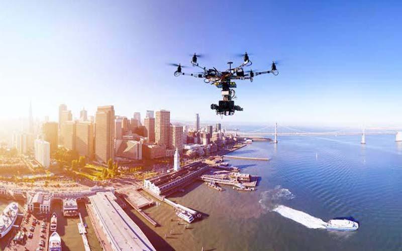
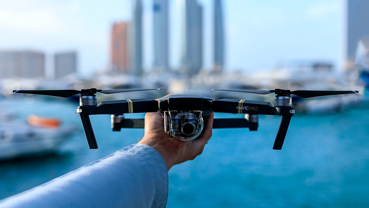
Los Angeles is a leader in visual storytelling. Real estate brokers and event coordinators are redefining how they present space and experience in a city where first impressions frequently take place on a screen. Conventional photography is insufficient today. Drone photography has emerged as the medium through which LA tells its most captivating tales, whether you are selling a million-dollar vista in the Hills or documenting a luxury brand’s rooftop party in DTLA.

Demand for the Best Aerial Photography Services in Los Angelesfor Real Estate & Events USA has increased due to the rise in high-impact images, not only because of their technological prowess but also because of their capacity to provide cinematic visuals that appeal to contemporary audiences.

A New Perspective for Real Estate Marketing

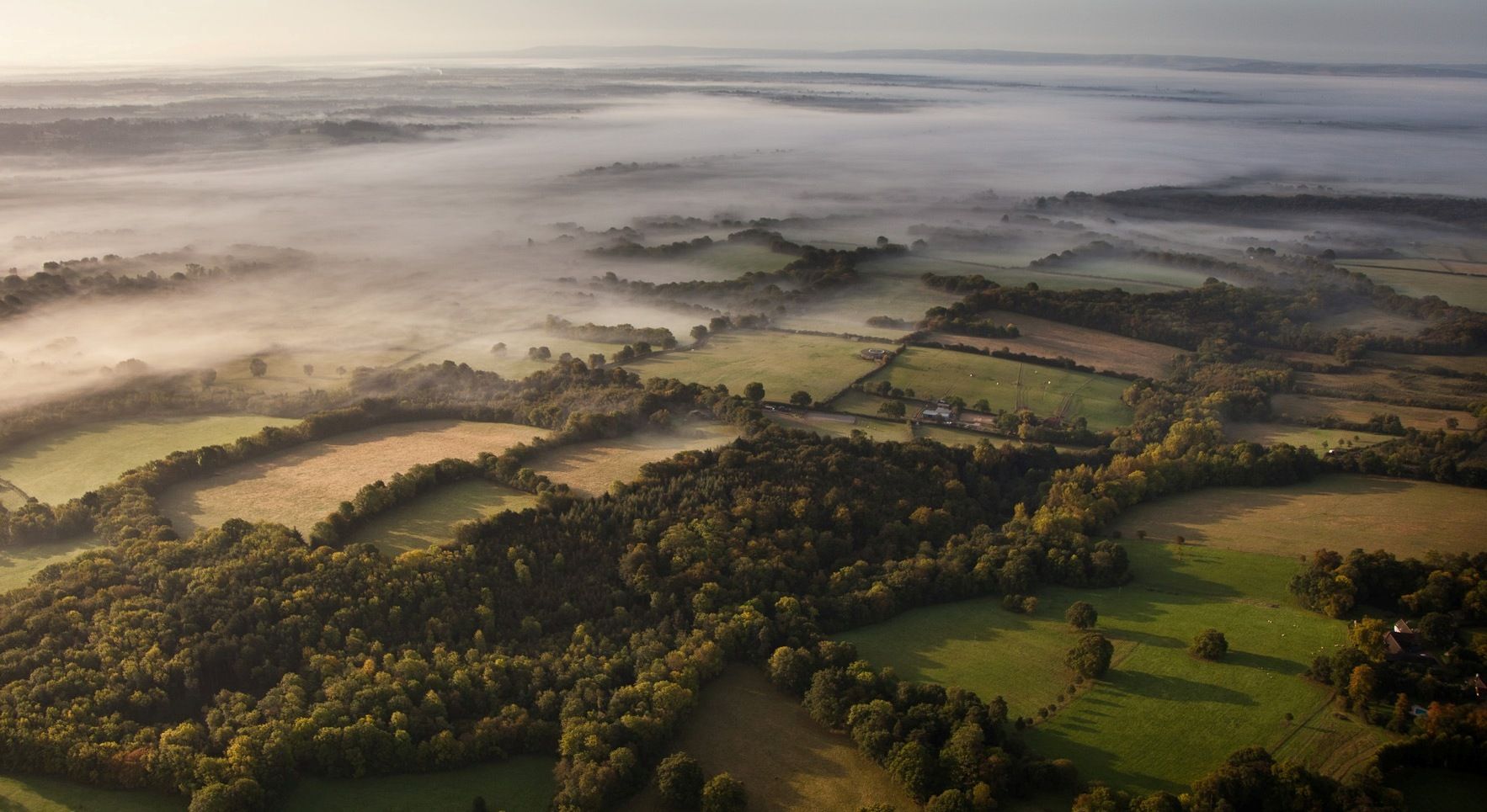
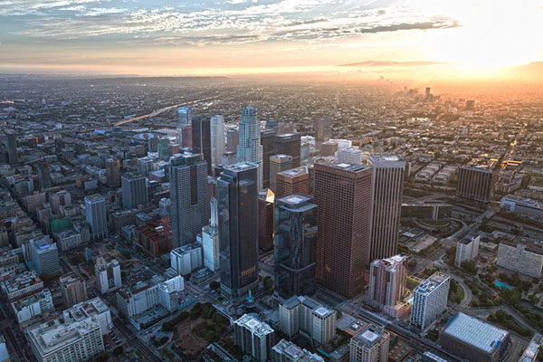
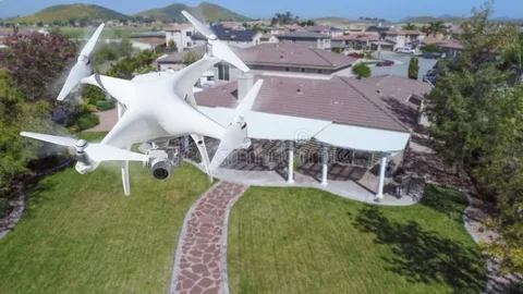
There is fierce competition in the real estate market in Los Angeles. Making an impression is essential, since the properties range from modern condos in the heart of the city to expansive estates on the hillside. Realtors may depict a property’s whole story via aerial photographs, including its layout, neighborhood, pool views, and even exposure at sunrise or sunset.

Traditional photography finds it difficult to match the emotional connection that this bird’s-eye perspective produces. Selling a lifestyle is more important than simply selling square space. Drone footage emphasizes nearby parks, beaches, and downtown, all important selling features that could increase the sale.

Elevating Event Promotion To New Heights

Impact is the main focus of all LA events, including private parties and marketing activations. High-end customers expect their experiences to be filmed in a way that is immersive and theatrical. Drone photography accomplishes this by providing wide views of outside spaces, backstage operations, audience reactions, and memorable moments from unusual perspectives.

Drone filming is commonly included in packages offered by the Best Aerial Photography Services in Los Angeles for Real Estate & Events USA. This allows event planners to produce captivating highlight reels, teaser films, and social media material that garners interest even after the event is over.

Efficiency Meets Creativity

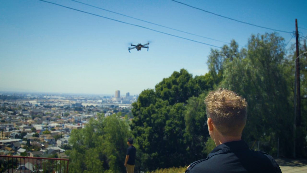
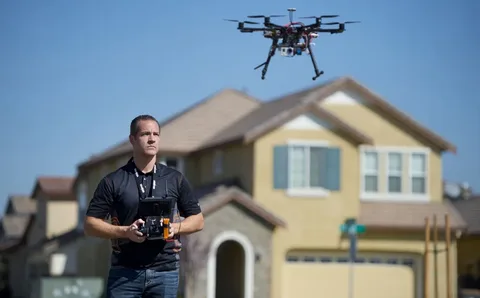
Additionally, drone photography saves money and time. Drones nowadays are compact, quick to deploy, and produce remarkably high-resolution video, so there’s no need for cranes or helicopters. Drone operators simultaneously combine technical proficiency with artistic vision. Telling a tale is more important than simply operating the drone.

Regulatory Knowledge Matters

Drone use is subject to stringent FAA regulations in Los Angeles, particularly in regions with high population densities or close to airports. Employing a qualified and seasoned staff guarantees peace of mind and compliance. Prominent suppliers understand how to operate under these restrictions without sacrificing the quality of the final product.

Final Take!

The right aerial graphics may enhance your message, amaze your audience, and boost return on investment, whether you are selling a penthouse in West Hollywood or throwing a rooftop banquet in Downtown LA. More professionals are turning to the Best Aerial Photography Services in Los Angeles for Real Estate & Events USA to realize their ideas.

Frequently Asked Questions

What makes drone photography effective for LA real estate marketing?
Drone photography showcases property size, layout, and surroundings, offering a more immersive and attractive view to potential buyers than traditional ground-level shots.

Can drone photography capture indoor event footage in Los Angeles?
While drones are ideal for outdoor venues, experienced operators can navigate select indoor spaces safely, especially in venues designed to accommodate aerial footage.

Are aerial photography services in Los Angeles FAA-compliant?
Top providers ensure FAA-certified pilots operate all drones legally and safely, especially in restricted areas around Los Angeles.

How does aerial photography benefit event marketing content?
Drone footage enhances social media, promo videos, and press materials by delivering unique visual angles that boost viewer engagement and brand recall.

Is drone photography affordable for small real estate listings or events?
Yes, many services offer tiered packages, making professional drone photography accessible for both luxury properties and intimate events across Los Angeles.


How Aerial Shots Can Help You Plan Better For Your Landscape Makeover

Aerial photography has transformed how we see and organize our environment, going beyond simply being a trend. Homeowners, architects, and landscapers are adopting a bird’s-eye perspective to visualize spaces in a completely new way, as drones are getting more and more popular. Aerial photography landscape in Los Angeles has emerged as a preferred approach for efficient landscape planning, from detecting layout inefficiencies to producing designs supported by data. Read till the end to explore how this powerful tool can transform your outdoor renovation journey.


See the Full Picture from Above

With aerial photography, you can capture your entire property in just a single shot. Aerial images provide you with a full, undistorted perspective of your property, layout, and elevation, unlike ground-level photos. When hiring a drone photography service in Los Angeles, this is very helpful as it helps determine the actual size of your space, uncover hidden problem areas, and identify places for improvement.


Plan Efficient Layouts with Precision

You can immediately overlay design concepts into high-resolution aerial maps using drone photos. A talented aerial photographer in Los Angeles can help you plan pathways, water features, seating areas, and plant placements precisely and with minimal guesswork. This results in efficient use of space, reduced waste of resources, and a clear visual reference for both the homeowner and landscaping team.


Track Development Throughout Construction

Aerial photography allows you to keep a close eye on the development of your project during the makeover. Drone photos taken every week or every two weeks may show you how your landscape is developing and help you identify construction mistakes early. With this, you can make quick decisions and ensure the design vision remains on track from beginning to end.


Showcase the Transformation Like a Pro

Beautiful before-and-after aerial photos are the ideal method to record and share your investment once your transformation is over. These photographs leave a lasting impact, whether you want to sell your house or simply want to appreciate the result. Similar to how aerial photography for live events in Los Angeles increases awareness and engagement, many clients also use aerial film captured during landscaping for marketing or community outreach.

Increase Property Value with Eye-Catching Design

Superior aerial imagery gives your real estate listings an edge. Buyers like a carefully planned, well-kept landscape, and aerial photos elegantly showcase your efforts. In addition to having the ability to influence perception, it justifies the pricing. Using a reputable drone photography for landscape in Los Angeles guarantees high-quality photos that enhance your property’s presentation online and in brochures


The bottom line

The use of high-tech solutions that benefit designers and homeowners is making aerial photography for landscape in Los Angeles a strategic planning tool rather than just a visual luxury. Drone shots streamline decision-making, enhance designs, and show outcomes like never before, from conception to completion. So it is time to take a fresh, literal look at your yard if you’re thinking about a landscaping overhaul.


FAQs

What is the purpose of aerial photography in landscaping?

By taking thorough aerial photos of your property it facilitates the planning, visualization, and monitoring of landscaping work.


How does aerial photography improve communication with landscape designers?

You and your designer can more easily and successfully discuss layout adjustments, scaling, and creative ideas when you have a common visual foundation with aerial views.


How can I find a reliable aerial photographer in Los Angeles?

Look for seasoned experts who have landscaping portfolios. Make sure to inquire about delivery formats, editing capabilities, and equipment.


Can I utilize aerial pictures for purposes other than landscaping?

Yes. Aerial photography is also utilized in construction, real estate, and live events in Los Angeles.


Is it costly to use drones for small-scale residential projects?

Not necessarily. For varying project sizes and budgets, several drone photography service providers offer customizable packages.


How Aerial Imagery Is Changing Industries?

Aerial imaging, which was formerly thought of as a future idea only used in movies or the military, is now a commonplace tool in several industries. Advances in drone technology, photogrammetry, and high-resolution images have made it possible for an aerial imagery company in Los Angeles, USA, to provide revolutionary insights that revolutionize everything from real estate to agriculture.

A New Perspective That’s Redefining Possibilities

These days, taking pictures of the earth from height is about more than just producing beautiful images; it’s also about acquiring useful, actionable, and frequently transformative data. Imagine being able to analyze large tracts of farmland with pixel-level precision or evaluate a construction site in real-time without ever setting foot on it. Photogrammetry Services in Los Angeles and other contemporary aerial solutions offer just that.

Let’s dive into how different sectors are experiencing this shift:

Construction & Infrastructure

Project managers can track developments, spot hazards, and enhance planning with the use of aerial images. Compared to traditional surveys, drone-based site inspections are safer, faster, and much more comprehensive. Businesses can create incredibly precise 3D site models that cut down on rework and expedite deadlines with photogrammetry services in Los Angeles.

Real Estate & Land Development

Listings augmented with drone photography for landscapes in Los Angeles get more views, display property potential, and help buyers understand space in context. Developers also utilize aerial imagery to plan subdivisions, track erosion, and examine topography before making expensive investments.

Environmental Management

Aerial imagery is essential for fighting wildfires and monitoring coastal erosion. Drone imagery is used by environmental organizations to better manage protected areas, model the effects of climate change, and investigate patterns.

Agriculture & Land Use

One of the main uses of aerial data is precision farming. It helps farmers keep an eye on crop health, identify irrigation problems, and apply treatments only when needed, which cuts down expenses and boosts yields.

Film, Media & Marketing

Visual enchantment must not to be overlooked. Filmmakers, advertisers, and content producers today depend on aerial imagery firms in Los Angeles, USA to produce captivating, cinematic images that were previously unattainable without helicopters.

Why Are Businesses Making the Shift?

Working with a seasoned aerial photography studio is a strategic choice rather than merely a visual enhancement. Businesses now have a competitive edge that was unimaginable ten years ago because of the combination of drone imagery, AI-powered analytics, and scalable solutions.

The Bottom Line!

Adopting aerial solutions is rapidly becoming an operational necessity, regardless of your industry: construction, real estate, farming, or media. It’s likely that your rivals are already using the bird’s-eye edge if you are not.

Frequently Asked Questions

What services does an aerial imagery company in Los Angeles, USA typically offer?
They offer drone photography, photogrammetry, thermal imaging, 3D mapping, and video production.

What is photogrammetry, and why is it useful?
Photogrammetry uses images to create accurate 3D models or maps, ideal for surveying, planning, and analysis.

How does aerial imagery benefit construction projects?
It improves progress tracking, site planning, safety assessments, and cost control.

Can farmers use aerial imagery for crop management?
Absolutely. Drones can detect plant stress, irrigation issues, and growth patterns.

How affordable is drone photography for small businesses?
Many companies in Los Angeles offer scalable packages, making it accessible even for small operations.


How Drone Videography Adds Drama and Depth to Your Event Story?

Imagine a stunning overhead shot of a wedding location at sunset captures the golden glow of the dancing floor, the decor, and the happy attendees in a single cinematic motion. This goes beyond only video coverage. This is aerial storytelling.

Welcome to the era of drone videography for events in Los Angeles, when eye-level shots are no longer the only option for your most significant events. Traditional videography just cannot match the drama, action, and passion that drone footage brings. Drones enable you to capture the event with breathtaking depth, whether you are organizing a corporate gala, a high-profile music festival, or a luxurious wedding.

The Sky is Your Canvas

Investing in drone videography for events in Los Angeles gives you access to a bird’s-eye perspective of your story in addition to some fantastic footage. Your video feels like a movie preview for the most significant day of your life because of the wide vistas, dynamic angles, and spectacular transitions.

Aerial film may help you frame your event within its surroundings, whether it’s a small beach wedding in Malibu or a large conference at a venue in downtown Los Angeles. Every shot gains context and vitality from the surrounding skyline, scenery, or throng, which becomes an integral part of the story.

Drama in Motion: Why Drones Make a Difference?

Entrances, performances, audience reactions, and joyous mayhem are all part of the action-packed events. Drones move through it all with ease, going with the current. They can rise above the scene for a broad perspective after zooming in on significant events. It’s like having a storyteller in the air.

Drone videography is a perfect fit for the dramatic, cinematic, and stylish city of Los Angeles. You are creating a cinematic experience rather than merely documenting memories.

Aerial Photography for Live Events Los Angeles: Next-Level Wow Factor

A highlight reel becomes a full-fledged experience when real-time aerial footage and expert editing are combined. Live event aerial photography in Los Angeles is starting to appear frequently at public gatherings, product launches, and concerts. Drones highlight the size of your event by capturing the crowd, venue layout, and stage design in real time.

Your event video can be transformed into a memorable memento or an interesting marketing tool with the addition of dramatic music and astute editing.

Choosing the Right Drone Company in Los Angeles

Drone footage is not all the same. The crew’s experience is what creates the magic. Expert drone companies in Los Angeles provide pilots with FAA licenses, filmmaking gear, and a creative vision that makes your event’s narrative come to life.

Examine their portfolio before hiring them, make sure they understand the kind of event you are hosting, and make sure they abide by all local drone laws.

The Bottom Line!

Drone videography is a game-changer, not just a fad. It gives your event story more drama, emotion, and amazing depth. Why settle for mediocre coverage when you can go bold with drone coverage, especially in a visually driven city like Los Angeles?

Frequently Asked Questions

What types of events can benefit from drone videography in Los Angeles?
Weddings, music festivals, corporate events, sports matches, and even private parties can all benefit from the cinematic flair of drone footage.

Is drone videography legal for events in Los Angeles?
Yes, as long as the drone company follows FAA regulations and secures necessary local permits. Always hire licensed professionals.

Can drones be used for indoor events?
Yes, with the right equipment and skilled pilots, drones can capture indoor footage safely and effectively.


How Aerial Photographers Elevate Travel & Tourism Marketing?

Storytelling is not only an art form but also a marketing tactic in today’s content-driven society. Moreover, images become the ideal way to convey a story when it comes to travel and tourism. An aerial photographer in Los Angeles, USA, can help with this by turning routine advertising into breathtaking aerial experiences.

There is no lack of scenic beauty in Los Angeles, from expansive coasts to famous cityscapes. But those palm-lined boulevards and sun-kissed beaches tell a different story from above. The height makes it more vibrant, captivating, and unforgettable. These aerial viewpoints easily arouse yearning in the modern traveler who is surfing through Instagram or watching a trip vlog.

The Sky Advantage in Tourism Marketing

Traditional photography has its limitations. Although street-level photos are fantastic, they rarely convey the whole atmosphere of a place. Travel marketers can now showcase stunning views of popular tourist destinations, such as the Santa Monica Pier and the Hollywood Hills, in a way that was previously impossible with static ground photography, thanks to aerial photography with drones in Los Angeles.

Aerial photographers provide an unrivaled advantage, whether they are advertising a boutique hotel hidden away in Malibu or displaying the expanse of the Los Angeles cityscape during prime time. Creating an atmosphere that invites people in is more important than only being aesthetically pleasing.

Capturing Emotions from Above

Travelers today are motivated by experience and emotion. They want to experience a place before making travel plans. A skilled aerial photographer in Los Angeles, USA knows how to do just that, crafting visual narratives that evoke awe, curiosity, and excitement. These stunning images increase interaction on websites, social media, brochures, and even ads.

Drone footage is increasingly used by hotels, tour businesses, and travel influencers to create immersive advertising campaigns. Drones create authentic and cinematic footage by flying over cityscapes, beaches, vineyards, and festivals.

Marketing That Goes the Extra Mile

The combination of drones and aerial photography has altered the competitive landscape for travel agencies and travel companies in Los Angeles. These aerials create credibility in addition to increasing visibility and reach. Professionalism, attention to detail, and a commitment to high-quality experiences are implied by excellent drone imagery.

Drone photography is also scalable. The content can be customized for various platforms and audiences, ranging from short-form reels to full-length promotional videos.

The Bottom Line!

Nowadays, marketing for travel and tourism focuses more on showcasing experiences than merely locations. Working with a skilled aerial photographer in Los Angeles, USA, allows tourism brands to express stories at a whole new level. The sky serves as both the launchpad and the boundary.

Frequently Asked Questions

What does an aerial photographer in Los Angeles, USA do for tourism campaigns?
They capture high-resolution, bird’s-eye visuals using drones to showcase landscapes, landmarks, and experiences, making destinations more appealing to tourists.

Why is aerial photography with drones in Los Angeles becoming popular in travel marketing?
Because it provides unique, cinematic perspectives that boost engagement on digital platforms and elevate brand image.

Can aerial photographers help small travel brands too?
Absolutely. From boutique hotels to local tour companies, aerial footage makes even small brands stand out.


Why Does Your Project Need Aerial Coverage?

Have you ever noticed a missing element in a picture? Now visualize that same moment from above; the scale becomes real, symmetry appears, and the scene spreads. That is how aerial coverage works. Whether you work as an architect, content creator, event planner, or real estate developer, incorporating aerial images into your project is not just amazing, but revolutionary.

You are ahead of the game if you are looking for the best aerial photography services in Los Angeles, USA. Let’s assess why aerial photography has become a creative necessity rather than a luxury.

A Whole New Perspective

Aerial photography adds dynamism to your project. It conveys narratives that are just not possible with shots taken from below. Drone photography improves the way your audience interacts with your images, whether you are capturing a vast estate or a setting for an event.

The top drone photography companies in Los Angeles can assist you in showcasing your work from perspectives that fully convey its splendor, including rooftops, surrounding landscapes, skylines, and structures, all captured in a single, stunning image.

Boost Credibility and Appeal

Do you want your listings to sell more quickly? Do you want your portfolios to highlight your architectural work? Your images will look more professional with aerial views. In fact, drone photography for landscapes in Los Angeles has become the norm for promoting tourists, documenting the environment, and selling upscale real estate.

When prospective customers view your project from above, it appears more transparent and trustworthy in addition to being impressive.

Ideal for Progress Tracking

Drone photography is very useful on construction projects. Frequent aerial updates facilitate better stakeholder communication, progress tracking, and delay identification. Compared to ground inspections alone, it is much more accurate, time-saving, and efficient.

Elevate Your Marketing Content

Aerial photos are popular on social media. They are captivating, dramatic, and very shareable. Engagement will rise virtually immediately when you incorporate cinematic drone footage into your digital marketing.

By working with the top aerial photography companies in Los Angeles, USA, you may acquire expertly processed images that are suitable for a variety of media, including websites and Instagram reels.

Cost-Effective and Safe

Conventional aerial photography required expensive helicopters. Drones now make it considerably less expensive and safer. You get versatile shooting, seamless tracking, and 4K images without going over budget.

The Bottom Line!

Are you still unsure about the value of aerial coverage? It’s your secret weapon in a world that prioritizes visuals. Drone photography gives your project more weight and complexity for everything from marketing to documentation. Give your audience a vision they won’t soon forget by collaborating with leading drone photography firms in Los Angeles.

Frequently Asked Questions

What are the benefits of using aerial photography for real estate?
It offers broader perspectives, enhances property appeal, and helps listings stand out in competitive markets.

Is drone photography safe for commercial projects?
Yes, certified drone operators follow FAA guidelines, ensuring safe and compliant aerial coverage.

Can aerial photos be used in marketing materials?
Absolutely! Aerial visuals significantly boost engagement on websites, brochures, and social media.


The Rise of Drone Photography in Concerts, Festivals & Sports

Aerial photography for live events in the UAE and Los Angeles is changing the rules in a time when the “wow factor” is a must. Imagine the clamor of the audience, the electric mood, and the sea of people lit up by stadium spotlights or stage lights at a concert, festival, or high-stakes sporting event. Imagine now that everything was captured from above, with expansive, cinematic shots that were impossible to get with ground-based cameras. Drones, our contemporary flying storytellers, can help with that.

Why Are Drones Taking Over Live Event Coverage?

Live events take on a new dimension with drones. They provide a higher perspective, physically, unlike ordinary photography. Event planners use drones and aerial photography for live events in Los Angeles to capture the size, intensity, and emotion of large crowds in a single image. Pretty images are not the only thing at stake. It’s about narrating a story from above, such as the synchronized motions of athletes in a stadium, the colorful explosions of a festival, or the flowing wave of hands during a concert.

Moreover, drone services companies in Los Angeles and elsewhere are up their game in fast-paced cities and vibrant hubs, where entertainment and innovation meet. They are providing everything from 4K real-time streaming to incredibly fluid cinematic images while adhering to stringent airspace laws. We are experiencing events as virtual participants rather than merely spectators thanks to this fusion of arts and technology.

From Local Festivals to Global Sports

For instance, consider a Los Angeles music festival. Imagine a drone hovering over the sea of people, taking broad views of the festival grounds before focusing on the performances, the audience’s response, and even backstage activities. Or consider a well-known football game in the United Arab Emirates. In addition to capturing the action on the field, aerial drones also record the venue’s magnificence and the crowd’s pulse. These serve as valuable marketing tools for sponsors, businesses, and organizers while also being memories for the guests.

The fascinating thing is that the elite are no longer the only ones using aerial photography with drones in Los Angeles. Drone services are becoming available for a variety of events in Los Angeles, including seaside sporting tournaments, charity marathons, corporate galas, and rooftop concerts.

The Future of Event Storytelling

Better, more immersive footage is what event coverage will look like in the future, not just more footage. We can anticipate capabilities like augmented reality overlays and real-time audience involvement (imagine live drone feeds on enormous screens) as drone technology advances. Drone aerial photography in the UAE and Los Angeles is creating moments rather than merely documenting them.

Think beyond the ground the next time you are organizing a live event, whether it’s amid the futuristic cityscape of the United Arab Emirates or the sun-drenched streets of Los Angeles. Think beyond it.

Frequently Asked Questions

What is aerial photography for live events?
Aerial photography captures live events from the sky using drones, creating stunning cinematic visuals for concerts, festivals, and sports.

How do drone services companies in Los Angeles enhance event photography?
Drone services companies offer advanced drone technology, skilled operators, and creative solutions that deliver unique angles and dynamic footage for live events.

Is aerial photography with drones in Los Angeles legal for live events?
Yes, licensed drone operators follow FAA regulations in Los Angeles, ensuring legal and safe aerial photography for live events.

Top 5 Industries That Benefit from Commercial Drone Photography

The integration of aerial technology into professional photography has completely transformed how businesses advertise their products, services, and events. A growing number of sectors are recognizing the enormous marketing and operational benefits of aerial views as drone technology advances and becomes more widely available. Ground-level photography just can not compare with the innovative visual approach that a professional Los Angeles drone photography service provides to businesses.


Aerial cameras offer dynamic movement, wide panoramic views, and dramatic viewpoints for captivating visuals that draw viewers in and convey size, context, and excitement in ways that were previously exclusive to big-budget films. Further in this blog, we have listed 5 industries that benefit from drone photography services.


Real Estate: Next Level Property Marketing

Aerial photos of a property turn regular listings into attractive displays, ensuring quicker sales at a higher price. Drone photography shows the neighborhood context that purchasers seek. It exposes the estate’s closeness to features like parks or beaches. Moreover, sweeping aerial approaches to luxury houses establish emotional bonds with potential buyers before they even set foot on the property.


Construction: Documenting Progress and Compliance

Drone photography is used by construction businesses to record project milestones, spot possible problems before they become expensive ones, and give clients progress reports. Aerial documentation every week produces useful visual data for quality assurance and possible dispute settlement. With thorough site visibility, project managers can monitor many work zones at once, allocate resources optimally, and maintain accurate scheduling throughout intricate structures with amazing efficiency.


Events: Capturing Scale and Energy

Whether they are sporting events, business get-togethers, or music festivals, drone photography captures the scale and atmosphere that make events unforgettable. A commercial drone photographer in Los Angeles highlights intricate setups and the excitement of large gatherings. These captivating images turn into effective marketing tools for upcoming events, persuading sponsors and prospective attendees by realistically capturing the event and creating a sense of anticipation.


Weddings: Creating Unforgettable Memories

Beautiful aerial photos that capture the grandeur of the venue and the ceremony settings from angles couples rarely experience on their wedding day are becoming more and more common in modern wedding photography. Drone photography covers elaborate outdoor events from above, shows complex venue layouts, and records creative group formations that are only visible from the sky. These unique airborne views turn into treasured memories that enhance conventional photography and provide couples with thorough visual documentation of their special day.


Photogrammetry: Precision Mapping and Modeling

Drone photography is used in photogrammetry to produce exact measurements and 3D models of sites, buildings, and landscapes. With this technology, architects, engineers, and developers may now get comprehensive site information without spending a fortune. With previously unheard-of precision and visual clarity, this program revolutionizes infrastructure assessment, refurbishment planning, and raw land evaluation.


Final words

These five industries show that Los Angeles drone photography has evolved from a new technology to a vital tool with real-world commercial advantages in a variety of industries. Working with a professional drone photography service is not just an investment in eye-catching photos for businesses looking to improve their visual content strategy; it’s a strategic decision that affects financial outcomes through improved technical documentation and visual storytelling.


FAQs

How high can drones fly for photography projects?

Up to 400 feet above the earth is the permissible operating altitude for drones. Our usual range for capturing the best aerial views is between 100 and 300 feet, depending on the subject and composition.


What happens if our planned shoot day gets ruined by bad weather?

We keep a careful eye on weather predictions and will reschedule at no extra expense if the conditions affect image quality or safety. Our flexible system for reservations takes unforeseen circumstances into account.


After a session, how soon can we expect to receive the edited drone photos?

Delivery typically takes three to five business days. However, for projects with a tight deadline, we provide 24-hour accelerated processing for a small extra cost.


Are your drones able to take both still photographs and video images?

Yes! Our expert drone systems simultaneously record 4K–8K video and 20–48 megapixel still photos. Both formats are provided as part of our all-inclusive service packages.


The Role of Drones in Enhancing Photogrammetry Accuracy and Speed

Drone integration has transformed the way professionals collect and analyze geographical data in recent years. These unmanned aerial vehicles, which provide previously unheard-of accuracy and efficiency, have revolutionized photogrammetry services in Los Angeles for sectors needing accurate measurement and mapping.


With this technological synergy, professionals can produce intricate 3D models, topographical maps, and geographical analyses with exceptional accuracy and a considerable reduction in project timeframes. Let’s explore the role of drones in engaging photogrammetry accuracy and speed in detail.


Enhanced Data Collection Efficiency

The process of gathering photogrammetry data has been significantly expedited by drones. While drone platforms can capture hundreds of high-resolution photos in a single flight, traditional ground-based photogrammetry techniques may take days to cover huge regions. Rapid data collecting has a direct influence on decision-making procedures and project schedules, making this efficiency especially useful in time-sensitive projects.


Superior Accessibility to Challenging Environments

Photogrammetrists can reach previously difficult or dangerous regions without endangering worker safety. It is now possible to photograph steep terrain, fragile structures, coastal erosion zones, and disaster regions in detail from a safe distance. Regardless of the intricacy of the terrain or safety considerations, this feature is especially useful for aerial photography for construction in Los Angeles, where thorough site documentation is essential.


Increased Data Resolution and Accuracy

With the ability to record photos with resolutions up to 100MP, modern drone-mounted cameras provide ground sampling distances (GSD) of less than 1 cm/pixel. The positional accuracy of these platforms is within 1-3 cm when paired with RTK/PPK GPS systems. With this precision, photogrammetrists can produce incredibly accurate 3D models and orthomosaics that outperform conventional techniques in terms of geometric correctness and detail.


Cost-Effective Operation and Scalability

The operational expenses of drone photogrammetry are much lower compared to conventional techniques. Data that formerly needed several surveyors and costly equipment may now be collected by a single drone operator. High-quality photogrammetric documentation is now economically feasible across a range of project scopes and sectors due to the technology’s effective scalability from small residential projects to large infrastructure undertakings.


Advanced Visualization and Analysis Capabilities

Photogrammetry software combined with drone-captured imagery produces strong visualization tools that improve project analysis and communication. In addition to performing volumetric calculations, teams are able to produce realistic 3D models, extract accurate data, and provide captivating visualizations. This skill has revolutionized aerial cinematography in Los Angeles, where precise spatial modeling enables the realistic pre-visualization of complex shots.


The Bottom Line

Drone usage in photogrammetry indicates an important shift in the way spatial data is collected and processed. Photogrammetry services in Los Angeles will use these aerial platforms more and more to provide quicker, more precise, and more thorough spatial documentation as technology and regulatory frameworks evolve. Drone photogrammetry is now not only beneficial but also necessary for professionals aiming for the highest standards in measurement science to retain technological excellence and a competitive edge.


FAQs


In Los Angeles, what kinds of weather are best for drone photogrammetry?

The optimum weather is clear, overcast days with winds of less than 15 mph. Los Angeles’s plenty of sunshine and low humidity make it the ideal place to take pictures all year long.


For large-scale photogrammetry projects, how much time can drones save?

When compared to conventional techniques, drones usually cut down on data collecting time by 60–80%.


What degree of precision may customers anticipate from drone photogrammetry services?

Los Angeles providers of RTK/PPK-enabled drones give vertical precision of 3-5 cm and horizontal accuracy of 1-3 cm, which is equivalent to traditional survey-grade equipment.


In comparison to conventional techniques, how do drones enhance the monitoring of construction progress?

Drones offer thorough weekly or daily site documentation, facilitating as-built comparisons, timeline verification, and accurate volumetric calculations that are just impossible with land approaches.


How 3D Photogrammetry Delivers Cost-Effective and Accurate Solutions?

Imagine a world where measurements are millimeter-perfect, maps are created from nothing, and intricate models are brought to life from a small number of photos. Welcome to the wonders of 3D photogrammetry services in Los Angeles, where accuracy and innovation coexist without going over budget.

However, how precisely does this cutting-edge technology provide precise and affordable solutions? Let’s dig deep: trust us, it’s more exciting than you may imagine.

The Magic Behind 3D Photogrammetry

Fundamentally, 3D photogrammetry uses high-resolution photos to capture real-world objects, places, and landscapes. 3D models that are remarkably detailed and quantifiable are produced by using sophisticated software to put these photos together. It resembles fusing a digital twin with reality.

Now, why are businesses, from real estate giants to architects and archaeologists, obsessed with it? Simple: it saves time, slashes costs, and delivers jaw-dropping accuracy.

Why Are 3D Photogrammetry Services in Los Angeles Game-Changers?

3D photogrammetry services in Los Angeles are robust in a dynamic, fast-paced city like L.A., where accuracy is just as important as originality. Conventional surveying techniques can call for expensive equipment, lengthy hours, and huge budgets. On the other hand, Photogrammetry is surprisingly accurate, lightweight, and agile.

Businesses may now take pictures of intricate structures and terrain in a matter of hours rather than weeks by working with a commercial drone photographer in Los Angeles. Moreover, regions that were previously thought to be “unreachable” are now clearly visible due to drones’ aerial superiority.

Imagine using only sophisticated flying cameras and state-of-the-art software to map a building site, a historical landmark, or even a luxury home. That is the power in question.

Top Drone Photography Companies in Los Angeles: Your Secret Weapon

It’s no coincidence that top drone photography companies in Los Angeles have become so popular. These professionals are more than simply drone operators; they are also digital cartographers, visual storytellers, and problem solvers.

They provide a full-service solution by combining drone photography and photogrammetry, from taking comprehensive pictures to producing usable 3D models. It is more intelligent, faster, and highly scalable.

How It Saves You Money and Boosts Accuracy?

  • Minimal Human Labor: Fewer boots on the ground mean fewer expenses.
  • No Rework: High-precision models ensure fewer mistakes and change orders.
  • Speedy Turnarounds: Capture, process, deliver, all at lightning speed.
  • Accessibility: Survey dangerous or hard-to-reach areas safely and affordably.
  • Data Richness: 3D models are packed with metadata, saving time in planning and design.

In summary: Reduced expenses, faster deliveries, and better outcomes. Isn’t that the ultimate goal?

Are you ready to add unparalleled authenticity and cutting-edge accuracy to your project? Explore the world of Los Angeles 3D photogrammetry services since mapping isn’t going to be flat in the future. It is three-dimensional, interactive, and colorful.

Frequently Asked Questions

Can 3D photogrammetry capture fine architectural details like carvings and textures?
Absolutely! High-resolution drones and advanced software can capture everything down to surface textures and tiny architectural nuances.

Is photogrammetry only useful for outdoor projects?
Nope. It’s just as powerful indoors, think warehouse mapping, interior designs, and even museums!

How does 3D photogrammetry compare to LiDAR scanning?
Photogrammetry is often more cost-effective and visually rich, while LiDAR offers better depth in dense vegetation. Choosing the right tool depends on your project needs.

Are drone photogrammetry services legal in Los Angeles?
Yes, when handled by licensed, FAA-certified pilots, which all top drone photography companies Los Angeles ensure.